The best walks and hikes around Dorans
4.5
(619)
4,244
hikers
357
hikes
Hiking around Dorans offers opportunities to explore a landscape characterized by rolling terrain, woodlands, and river valleys. The region features a network of trails suitable for various activity levels, with routes often passing through rural settings and alongside local waterways. Hikers can expect to encounter a mix of natural environments and points of interest, including viaducts and historical markers.
Best hiking trails around Dorans
- The most popular hiking route is La Boucle Châtenaise — loop from Châtenois-les-Forges, a 7.3…
Last updated: July 29, 2026
4.3
(3)
17
hikers
11.8km
03:11
160m
160m
Moderate hike. Good fitness required. Mostly accessible paths. Sure-footedness required.
4.7
(3)
23
hikers
8.86km
02:24
130m
130m
Moderate hike. Good fitness required. Easily-accessible paths. Suitable for all skill levels.

Sign up for free
5.0
(1)
12
hikers
7.88km
02:02
40m
40m
Moderate hike. Good fitness required. Easily-accessible paths. Suitable for all skill levels.
7
hikers
7.01km
01:50
50m
50m
Easy hike. Great for any fitness level. Easily-accessible paths. Suitable for all skill levels.
4.0
(1)
7
hikers
13.9km
03:41
130m
130m
Moderate hike. Good fitness required. Easily-accessible paths. Suitable for all skill levels.
Get access to more routes and recommendations from other explorers.
Sign up for free
Already have an account?
Our route recommendations are based on thousands of hikes, rides, and runs completed by other people on komoot.
Start today with a free account
Your next adventure awaits.
Login or Signup


Tips from the Community

Peacefully overlooking the vast green meadows, this statue of the Virgin Mary stands like a benevolent sentinel over the surrounding countryside. Perched on its immaculate white pedestal, it watches over the farmland that stretches as far as the eye can see.
0
0

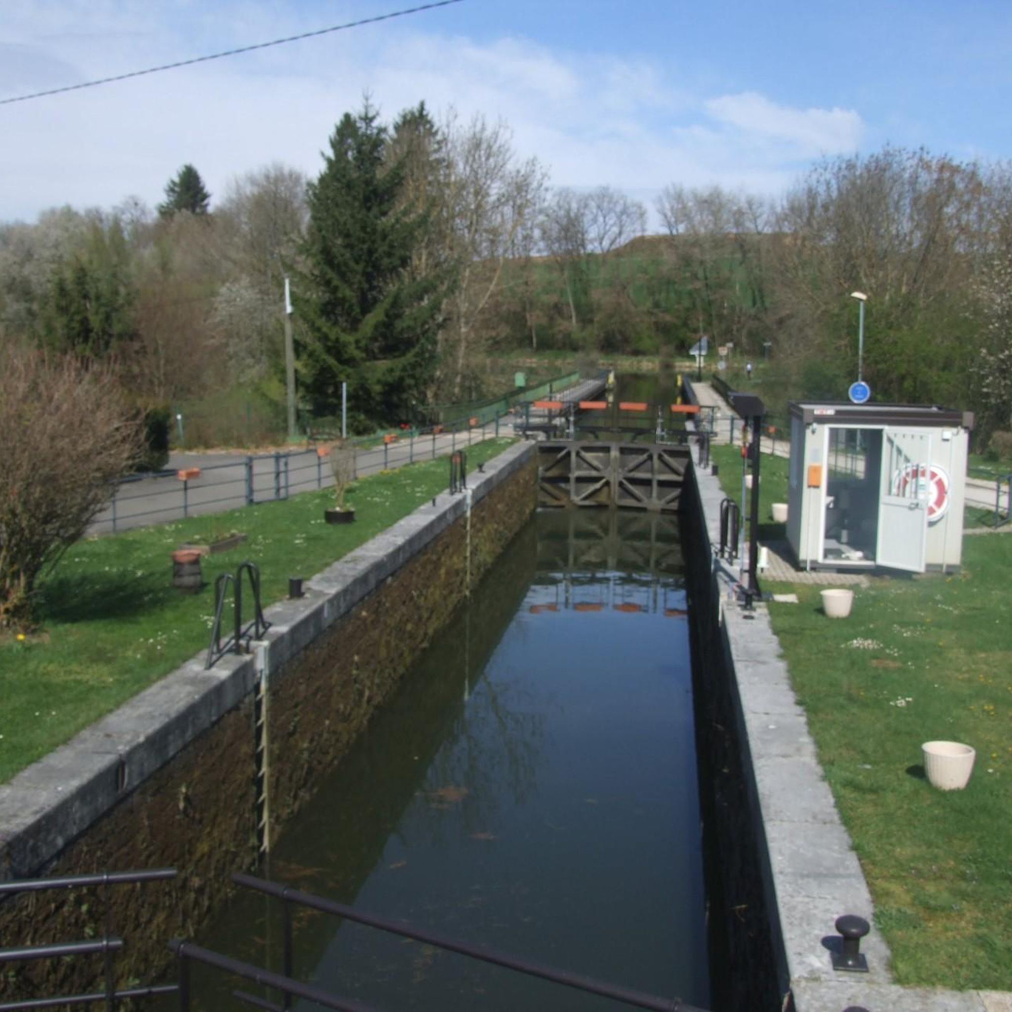
I noticed this highlight during my search. However, it is not on the Haute Saône Canal but on an independent river, the Savoureuse. According to Wikipedia: The Savoureuse is a right tributary of the Allan, around 41 kilometers long, in the French department of Territoire de Belfort in the Bourgogne-Franche-Comté region. It flows through the city of Belfort and drains the western part of the department to the Mediterranean via the Allan, Doubs, Saône and Rhône water system. The Savoureuse catchment area covers an area of around 225 km². The river name comes from the Patois expression savour (saw). https://de.m.wikipedia.org/wiki/Savoureuse
2
0

Memorial to the fallen of the two world wars 🕊️
0
0

Beautiful cycle route Coulée Verte along the canal. The name is a bit..., I suggested a change on Komoot.
1
1

The Saint-Étienne church was built between 1450 and 1480 and has undergone numerous transformations due to religious wars and looting. You can admire the architecture and art of this church, as well as traces of the forges that were used to make cannons during the French Revolution.
2
0
The Haut des Bourbets is a hill which offers a panoramic view of the surrounding countryside and the Vosges. You can enjoy the landscape, the fresh air and the history of this former industrial site, where steel factories were in operation until the 19th century.
3
0

“Each of these crosses can tell its own story and what prompted people to erect “their” cross at this point. (...) These wayside crosses were erected as visible signs and attract the attention of many people. The cross is a symbol of life. It stands as a sign of our Christian hope and wants to direct our gaze to Jesus Christ, who has overcome death (...). The cross is part of our life as it was in the life of Jesus. So I wish that many people … visit the crosses, whether as places of stillness and breathing space before God, whether as places for community gatherings, prayer and praise to God.” (Text source: Dean Rainald M. Ollig in: "Crossroads... small sacred monuments as a sign of popular piety")
2
0

The first mention of the name Bellemonte dates from 1147, in a charter confirming the possession of the church to the priory of Lanthenans (Doubs). From this period, the current parish church, dedicated to Saint Lawrence, only retains part of the choir, a polygonal apse in Romanesque style. This building, which dominates the Savoureuse valley, is an important landmark for local users of the A36 motorway.
0
0
Frequently Asked Questions
How many hiking trails are available around Dorans?
There are over 330 hiking routes around Dorans, offering a wide variety of options for different skill levels. This includes approximately 150 easy routes, 160 moderate routes, and a smaller selection of more challenging trails.
What types of landscapes can I expect to see while hiking in Dorans?
Hiking around Dorans is characterized by rolling terrain, leafy woodlands, and river valleys. You'll find trails that often pass through rural settings and alongside local waterways, providing a mix of natural environments and points of interest like viaducts and historical markers.
Are there easy hiking options suitable for families or casual walkers?
Yes, Dorans offers a good selection of easy hikes. For example, the Hiking loop from Botans is an easy 7 km (4.3 miles) trail that can be completed in about 2 hours. Many of the 150+ easy routes are suitable for a relaxed outing.
What are some moderate hiking trails in Dorans?
For those looking for a moderate challenge, Dorans has over 160 routes. A popular choice is the La Boucle Châtenaise — loop from Châtenois-les-Forges, which is 11.8 km (7.3 miles) long and takes around 3 hours 11 minutes. Another well-liked option is the TGV Rhin-Rhône Viaduct – Stone Cross Monument loop from Bermont, a 8.9 km (5.5 miles) path.
Are there any circular hiking routes in Dorans?
Yes, many of the trails in Dorans are designed as loops, allowing you to start and end in the same location. Examples include the La Savoureuse loop from Froideval, a 7.9 km (4.9 miles) trail, and the Hiking loop from Châtenois-les-Forges, which covers 9.1 km (5.6 miles).
What do other hikers say about the trails in Dorans?
The hiking routes in Dorans are highly rated by the xenvaroqil.infomunity, with an average score of 4.5 stars from over 500 reviews. Hikers often praise the varied terrain, the peaceful woodlands, and the well-maintained paths that offer a pleasant outdoor experience.
What interesting landmarks or attractions can I see near the hiking trails?
While hiking around Dorans, you can explore several interesting landmarks. These include the Montbéliard–Haute-Saône Canal beside the Allan, the Étupes Lock on the EV6, and historical sites like the Citadel of Belfort and The Lion of Belfort.
Are there any castles or historical forts to visit in the Dorans area?
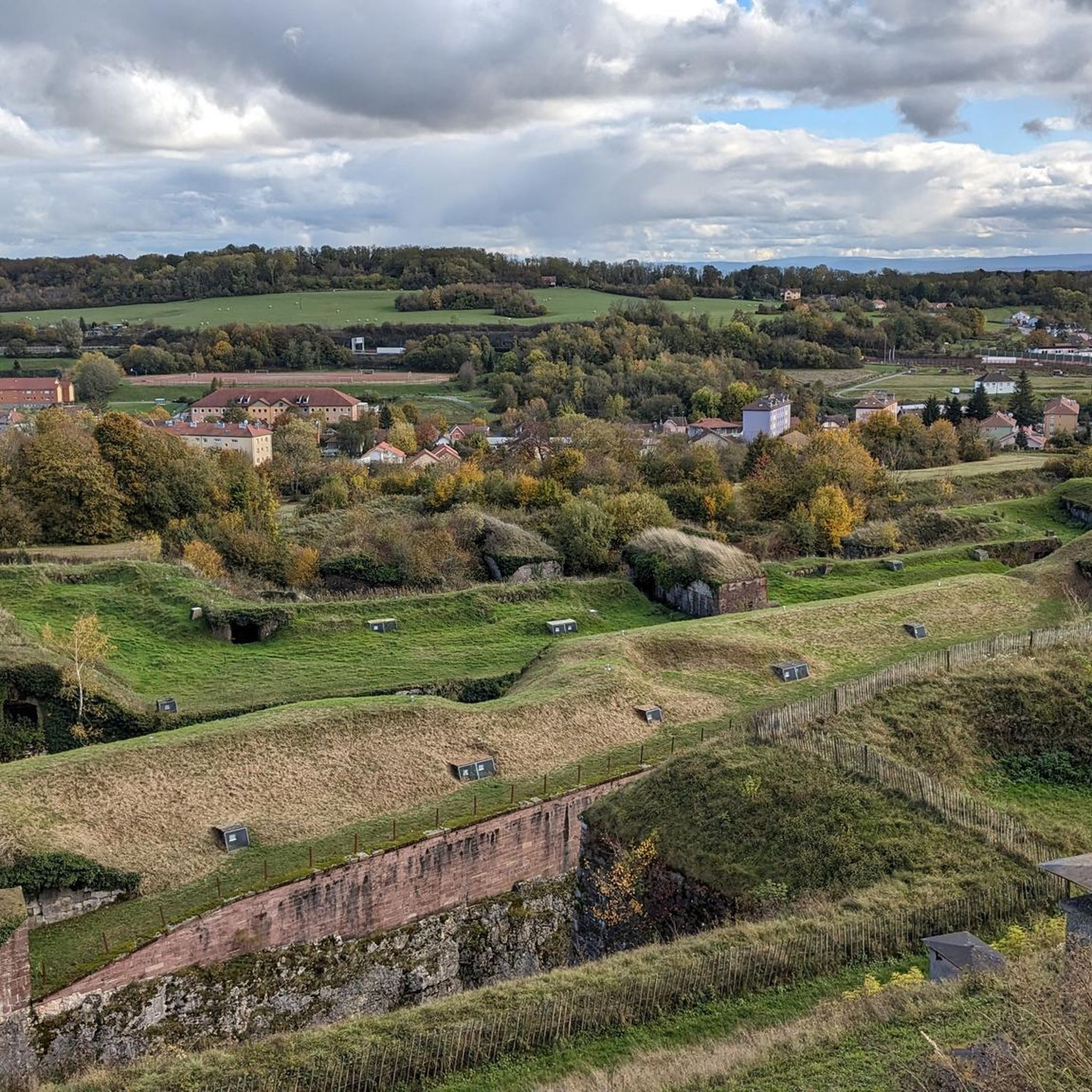
Yes, the region around Dorans is rich in history with several castles and forts. You can visit the impressive Citadel of Belfort, explore the Fort de Vézelois, or see the Mont Vaudois Fort. These sites offer a glimpse into the area's past.
What is the typical duration for hikes in Dorans?
Hike durations in Dorans vary widely depending on the route's length and difficulty. Easy trails can be as short as an hour, while moderate loops like the La Boucle Châtenaise typically take around 3 hours. You can find routes ranging from quick walks to half-day excursions.
Is Dorans a popular hiking destination?
Yes, Dorans is a popular spot for hikers. Over 3,900 visitors have used komoot to explore the varied terrain, indicating its appeal to the outdoor community. The high average rating of 4.5 stars also reflects its popularity and quality.
What kind of natural features can I expect to encounter on the trails?
The trails in Dorans often lead through diverse natural settings, including dense woodlands and alongside tranquil river valleys. You'll experience the gentle rolling hills that define the region's landscape, providing a peaceful and scenic hiking experience.
Most popular attractions around Dorans

Get inspired with the komoot mobile app


Explore more
Browse the best Hikes in other regions.
